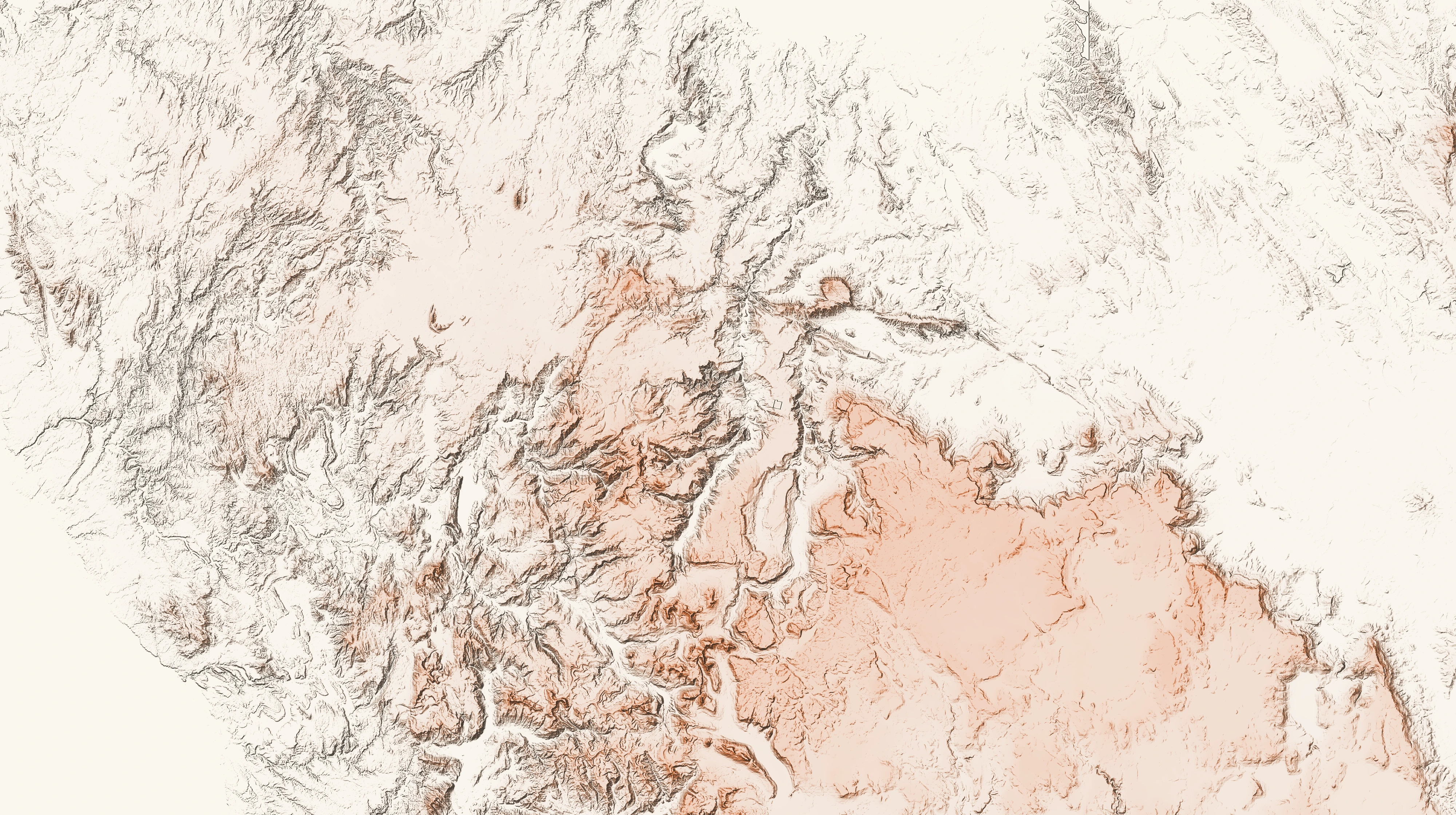
TLN-001 · Mersey Forest, TAS 7304
Emu Plains, Mersey Forest
This site is a large agricultural holding perched on a plateau situated between the valleys of the River Forth at the Lemonthyme power station and the Mersey River, 45 minutes out of Sheffield. It sits beneath the Elders, Kooparoona Niara (Great Western Tiers), and Wulinantikala (Cradle Mountain).
It’s advertised for grazing, but its custodians would need to want cold and wind.
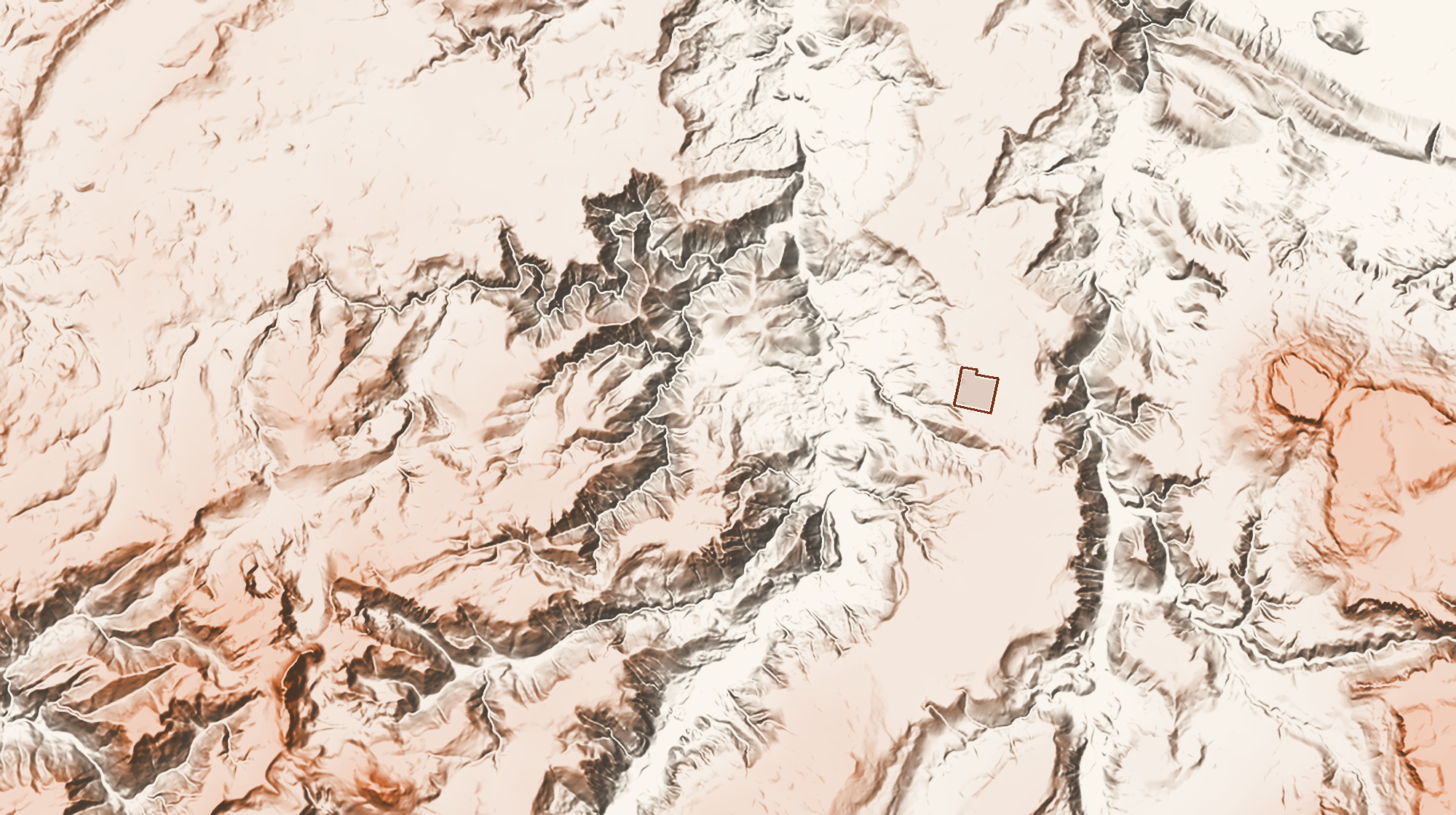
Reading the landscape
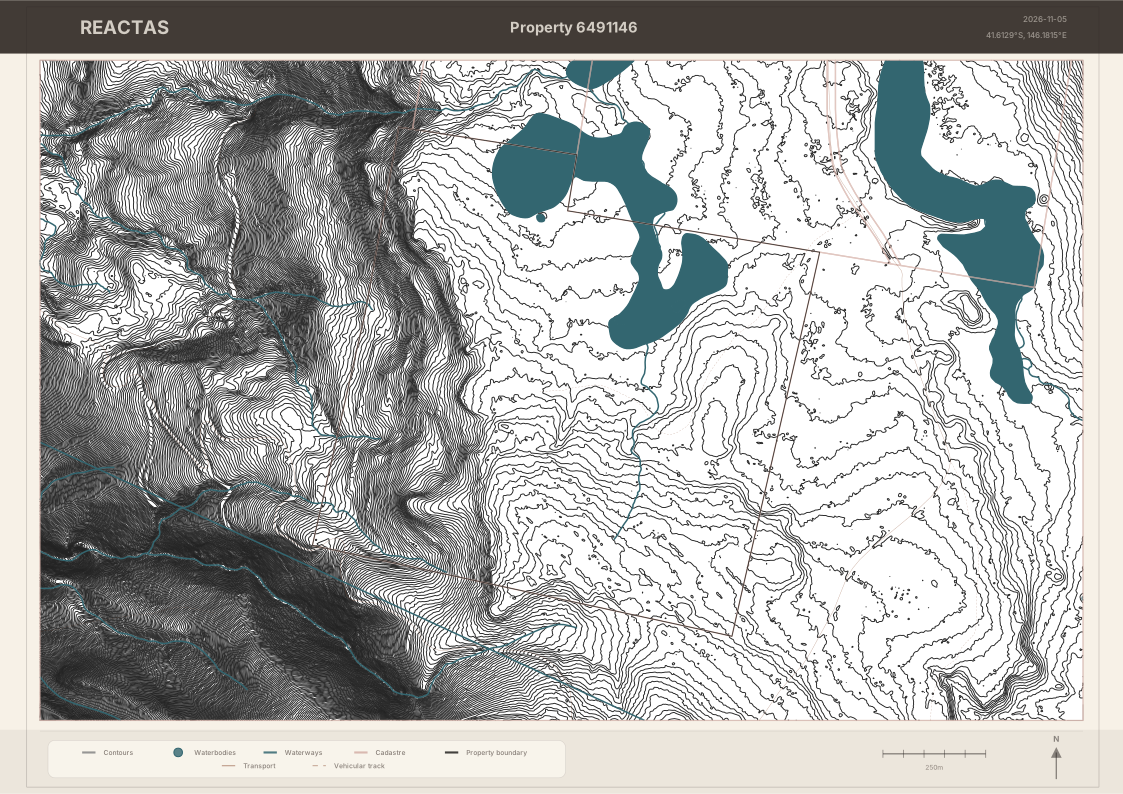
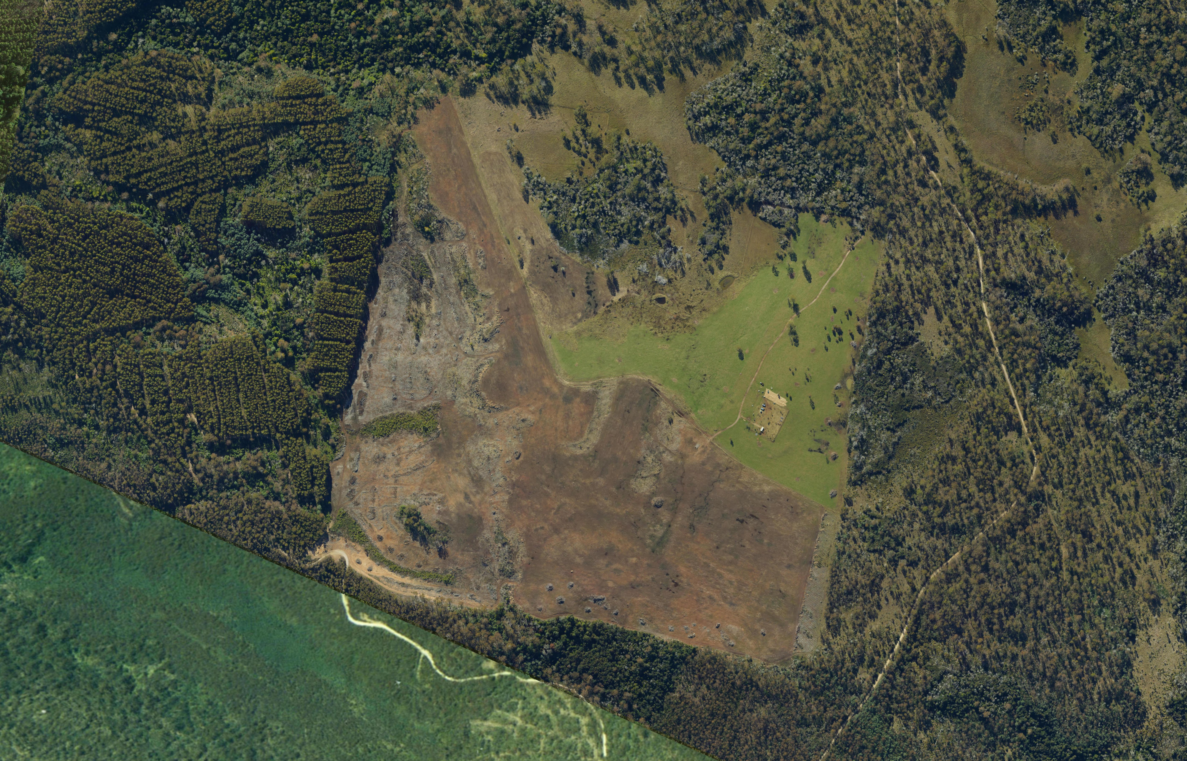
The landform is interesting as a mostly flat pasture with walls of trees surrounding from the bordering Sustainable Timber Tasmania (STT) properties. This parcel falls sharply at its western edge, where aerial imagery shows considerable clearfell logging has taken place. Approx 30ha of the land is sloped to the west, while the rest slopes gently north but is mostly flat.
The eastern half (and more broadly, the ridgeline plain) of the land is Cambrian granitic / acid igneous plain, typically stony but deep permeable soils, open forest and grasslands, potentially button grass and sedgelands; while the west is Tertiary basalt plain, often uniform and deep volcanic ferrosol capable of supporting tall canopy trees with good rooting depths, including mountain white gum (euc. dalrympleana). For comparison, the same basalt land system is found on the Middlesex Plains near Cradle Mountain, as well as spreading east and south from the town of Waratah.
Three dams are on site, bordering an area marked as wetland on topographical maps but appearing to be dry on aerial imagery. The mapped wetland covers 15.2 ha, with approximately 7-8 ha inside the property boundary. This wetland may be seasonal in nature or degraded by grazing. TASVEG maps Highland Poa grassland (GPH) on the wetland within the neighbouring properties’ boundaries. Aerial imagery suggests the grassland continues onto this site, where TASVEG maps the area as Agricultural land (FAL). This area is a candidate for grassland regeneration and protection from grazing.
For wetlands at the intersection of the two soil types, we may find sedgy flats, peaty hollows, sphagnum/buttongrass-type vegetation, and drainage-line scrub. Those areas may be ecologically valuable but poor candidates for disturbance, roads, grazing pressure, or cultivation.
A 3.5ha area of Eucalyptus tasmaniensis dry forest and woodland (DDE) sits next to the wetland, an open forest with little ground cover. There are patches of regenerating Acacia dealbata forest (NAD), while the rest of the land (~93ha) is classed as Agricultural land (FAL).
The surrounding STT production forests are actively under management, with two logging coupes of extensive eucalypts identified in their three year plan for harvest under a ‘Shelterwood Removal’ harvest system in 2027. This type of harvest is selective and designed to aid in the regeneration and health of a forest, but does conflict with cultural or residential use of the site. Anyone living here would need to take into account the noise from harvesting and the change in the view from the property.
Site History
Climate interpretation
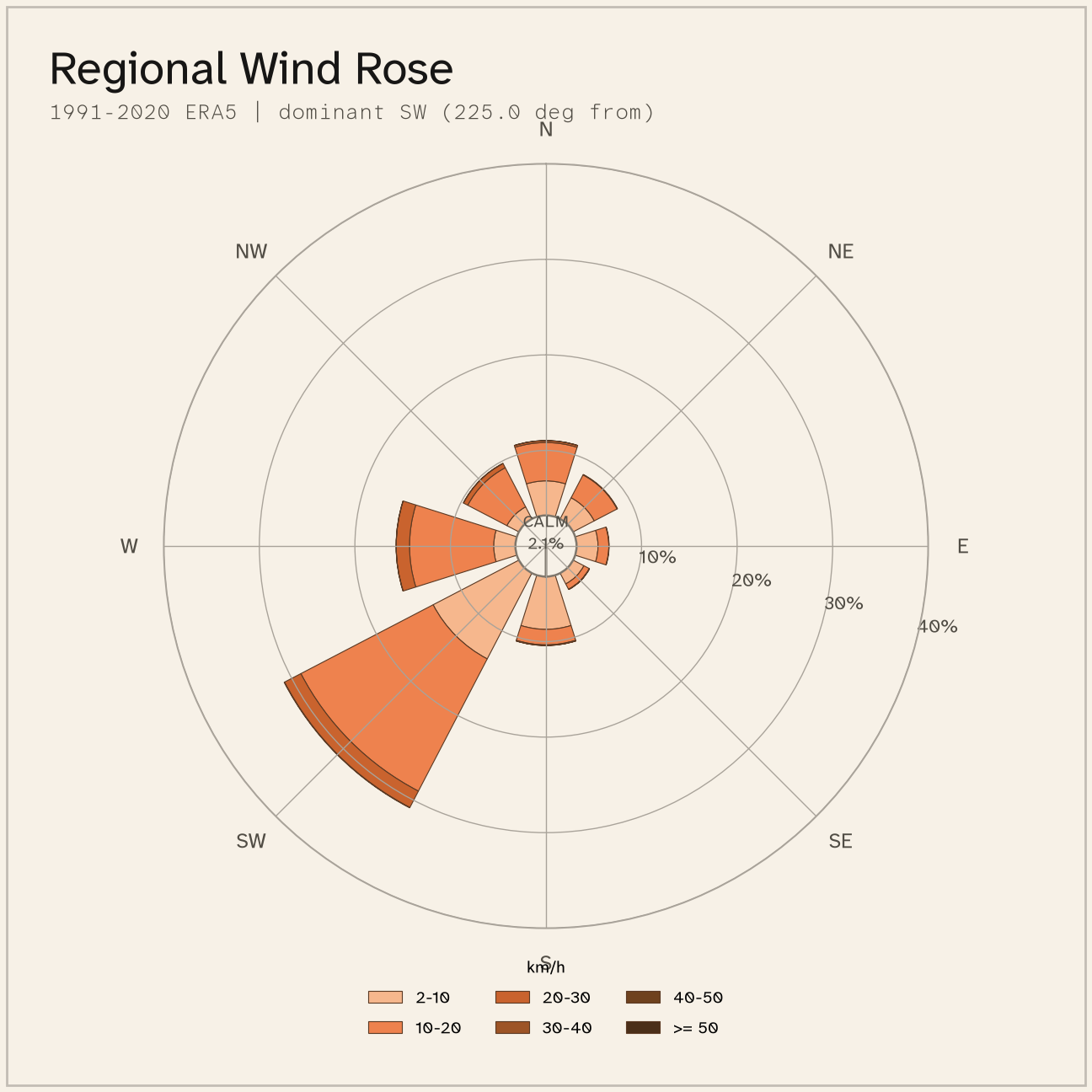
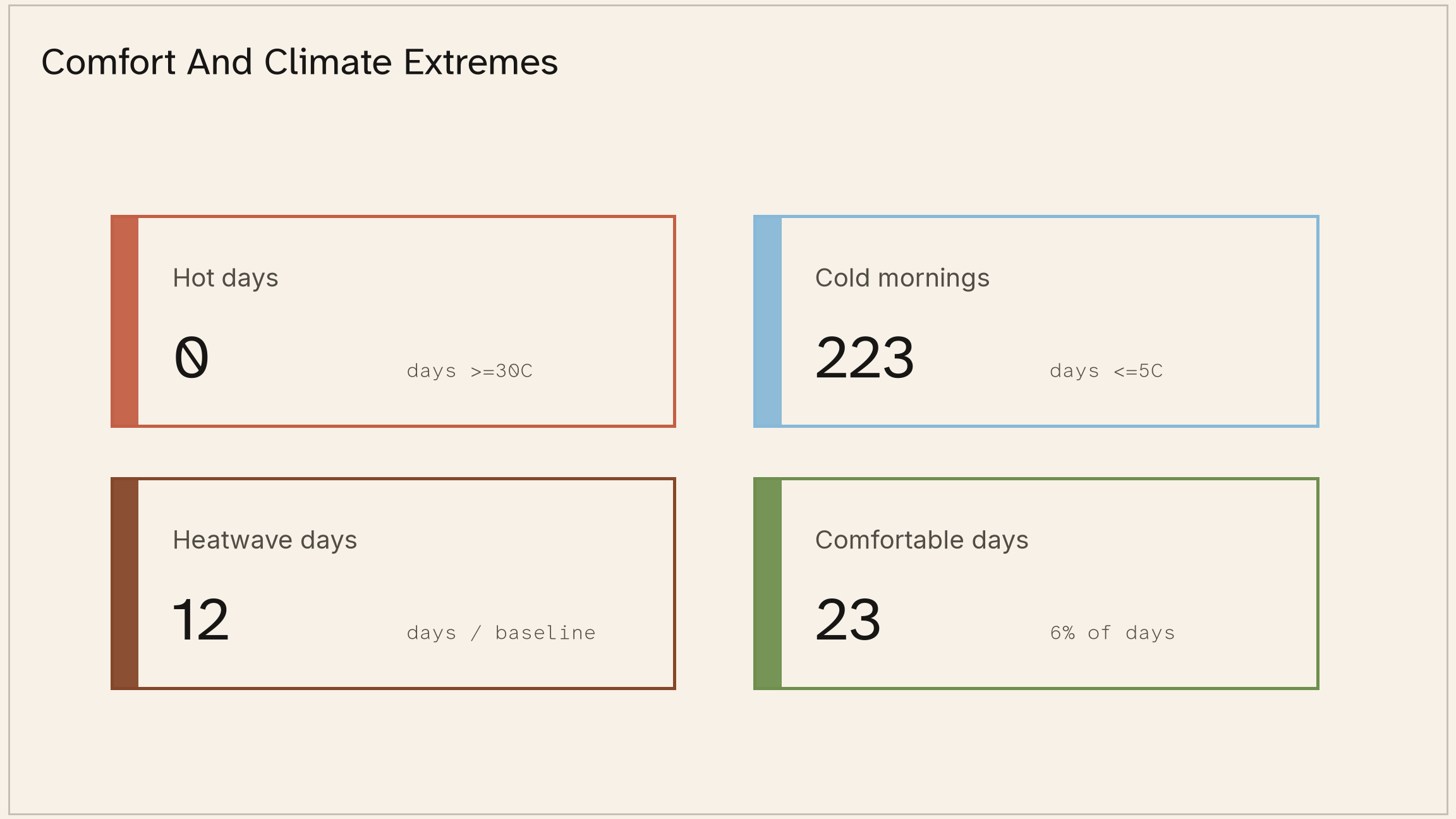
This site would not be comfortable for most of the year, mostly due to the number of cold mornings as well as high wind exposure. Wind events could be extreme, but the mean wind speed is not as high as other similar plateaus due to the influence of Cradle Mountain on the prevailing straight line winds of spring. Wind that does come off the mountain can be particularly icy and unpredictable despite its effect on mean wind speed.
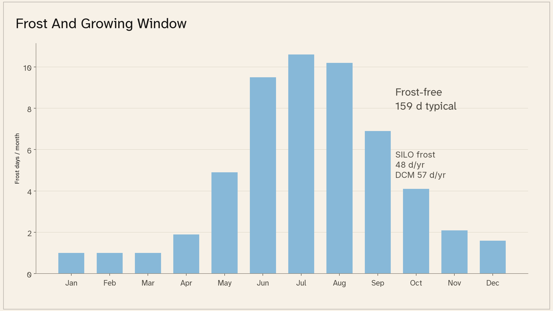
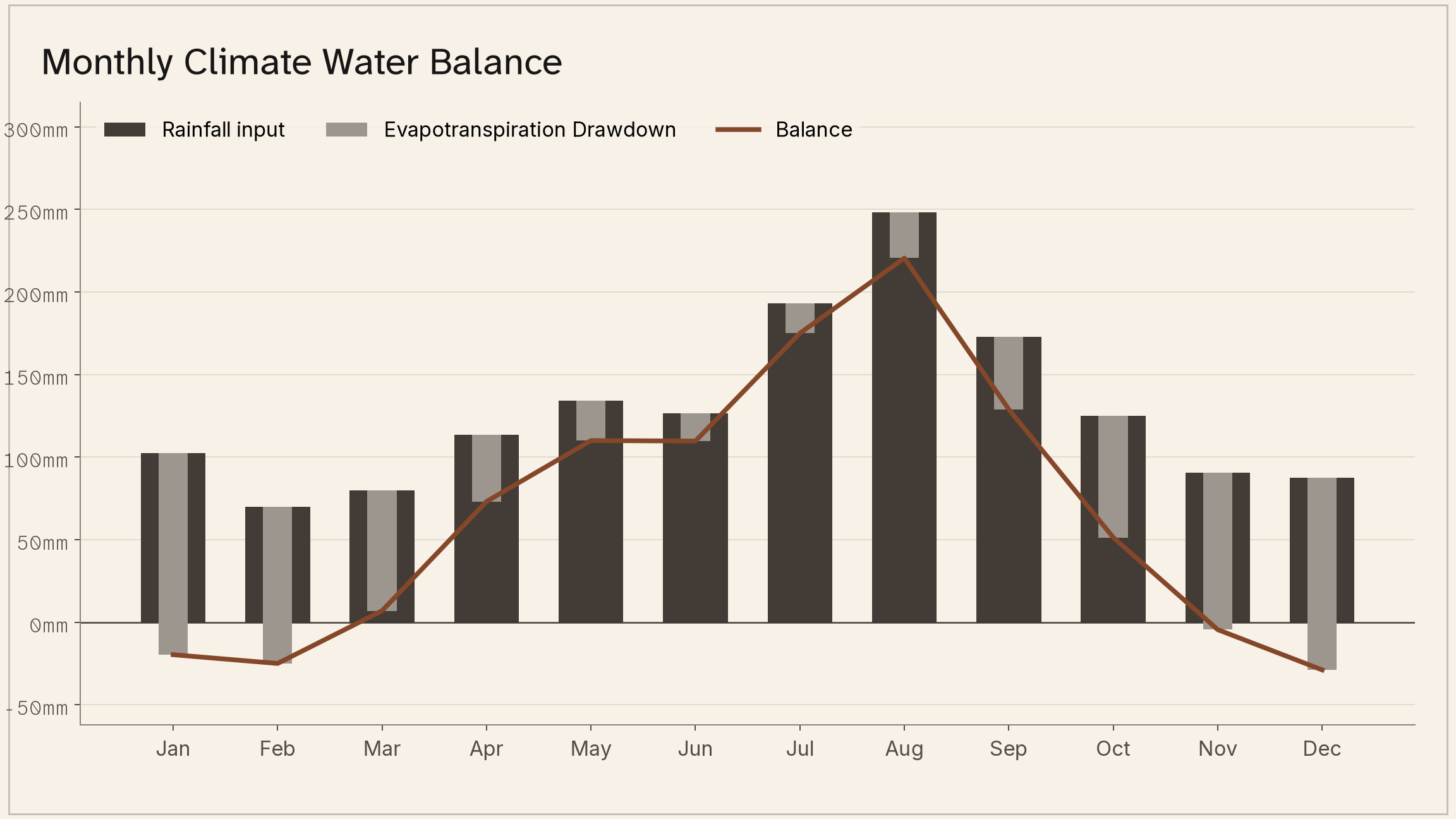
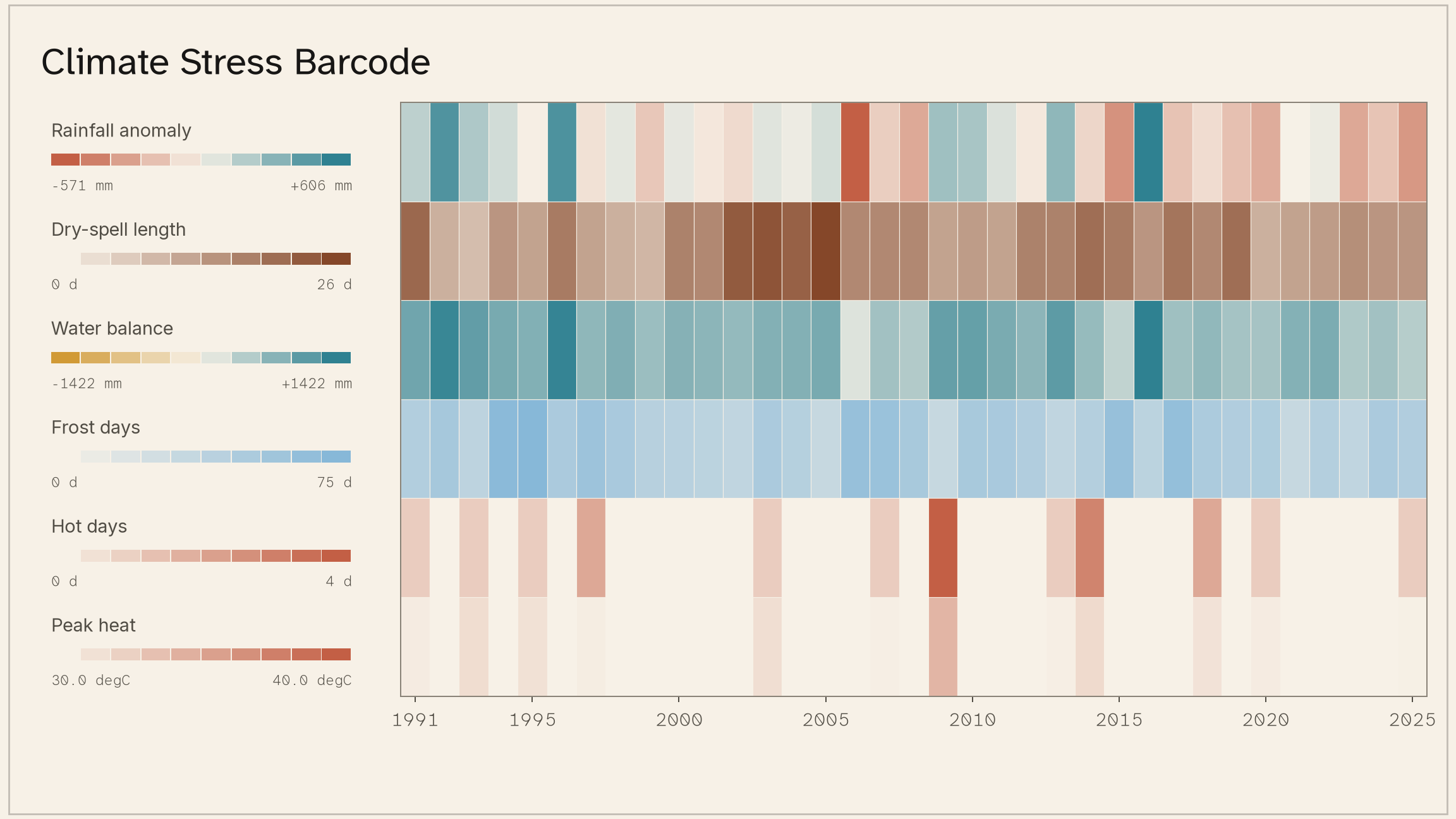
Frost free period is decent but extreme events bring risk of frost to a high proportion of the year. Rainfall is very high and drainage would be more of a concern than water security. Generally though the site is temperature constrained. Any enterprise here would need to want low temperatures, low growing degree days, and the people would need to want cold and wind.
To provide a real world comparison - this would be half way between the climate of Lorinna and that of the highland lakes region. Low and warm enough to support tall trees and faster tree growth than the highlands, but much less suited to human habitation than the sheltered Lorinna valley.
Production interpretation
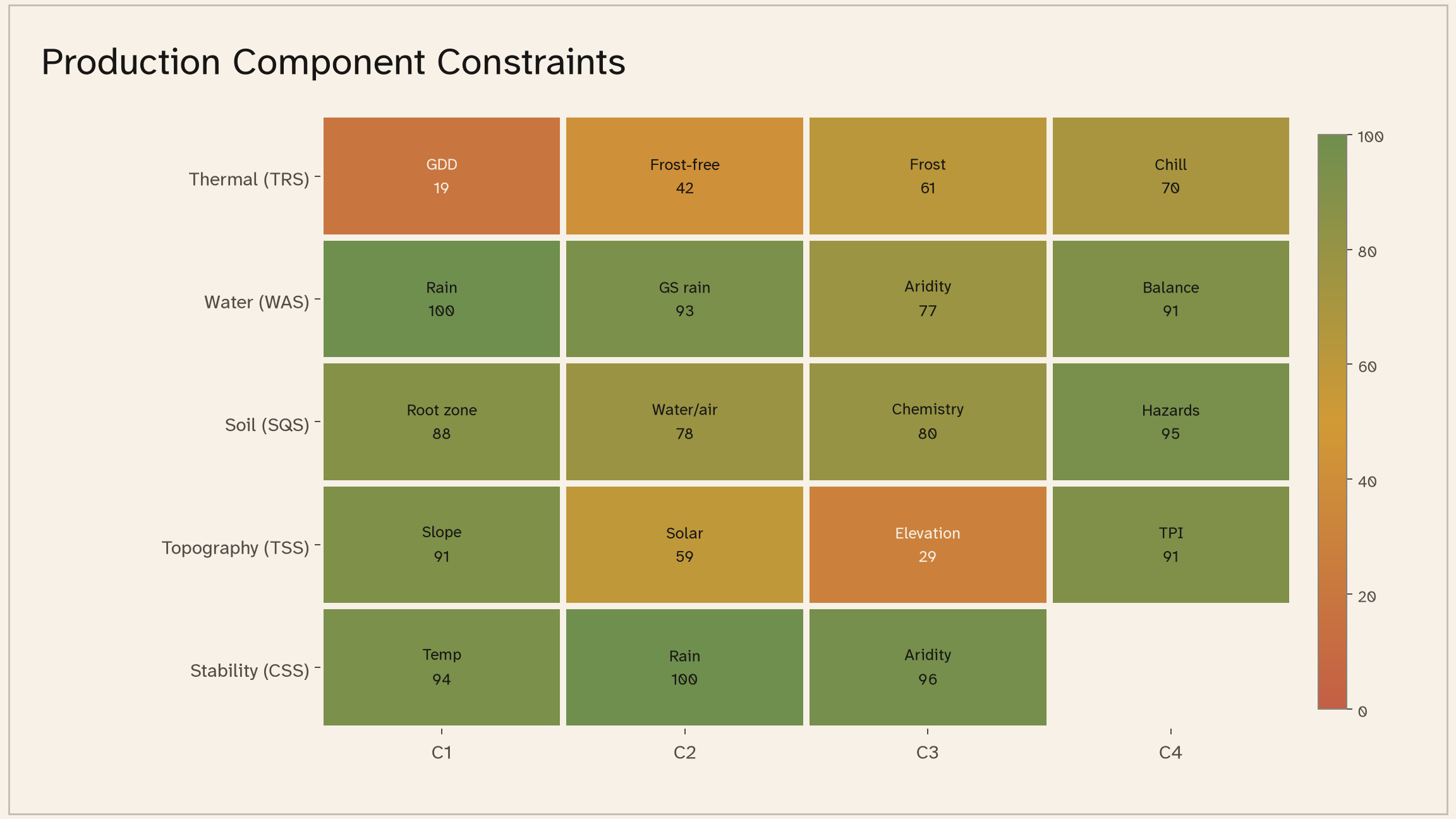
Agricultural prospects for this land are heavily constrained by climate, with thermal regime being the primary factor. Water, soil, topography are all extremely suitable to enterprises that want high rainfall and high water availability. The presence of extensive cleared pasture on high quality soils combined with the surrounding production forestry use makes the site best suited to a mix of native regeneration, silvopasture, and well managed ethical forestry.
Eucalyptus nitens would be the most suited commercial crop from a traditional forestry perspective, and could be used to form stands of wood for various local uses, and as part of a managed regeneration strategy. Acacias would form an excellent nitrogen cycling aspect of any system here, and as nursery trees for pioneer copses and tree guilds. These should be propagated from existing healthy trees on site, and should not be imported stems.
The pasture value is extremely high, but the cold exposure is a consideration in selection of animals. Further analysis is required to determine stocking rates of various livestock in any system established here. Any heavy livestock introduce risks of pugging, compaction, and damage to wetlands and native plants. Any use of livestock must strictly be managed according to regenerative principles, with high rest times between intense mob grazing, and full exclusion from waterlogged or sensitive areas.
Intervention
A potential integrated system suitable to this site would be a silvopasture system composed of widely spread nodes of a mix of tree, shrub, and ground species. The species mix would require further analysis, particularly around the draining of the soil.
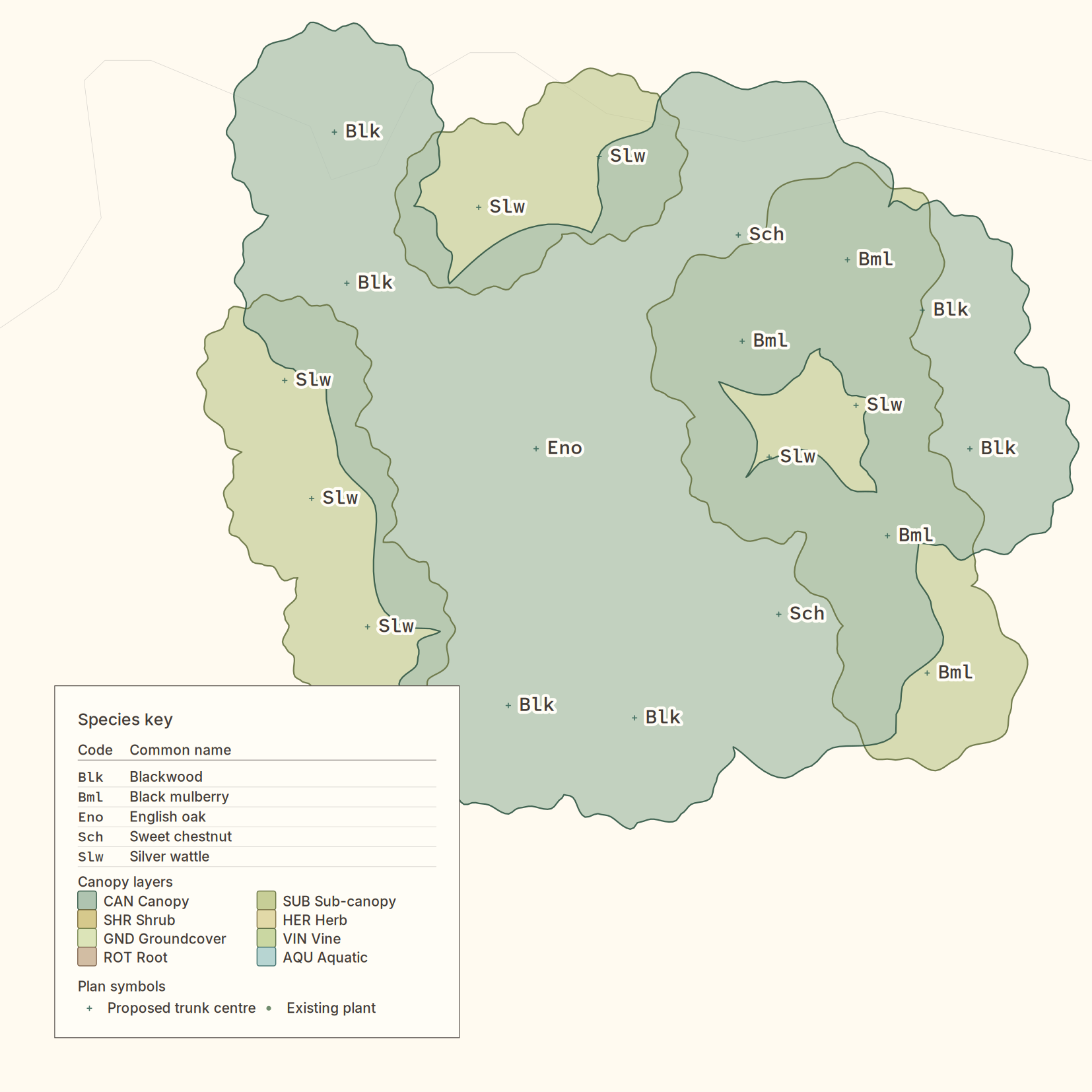
A single guild node would be approx 15m in diameter and composed of: 1x English Oak (or Sessile), 2x Chestnut (of different cultivars for pollination), and a mix of sacrificial nursery acacias (silver wattle and blackwood). Shrub and ground layer would be locally adapted natives, and livestock would be excluded until maturity. Hazel and mulberry could be incorporated for animal fodder if pollarded above browsing height.
Active management would be required to cull excess planting and maintain airflow. At maturity, we would expect only 1 or 2 acacias would remain in each node. Nodes would be planted at a rate of 3-4 per ha, with ~60ha being suitable for this use.
This system could provide a substantial combination of human food yield and fodder, such as in the oak-raised pork of Europe, once it reaches maturity in decades. This could be a significant intergenerational food security asset with the right management.